 www.frogfish.ch

Lophiocharon hutchinsi
(Pietsch, 2004)
Hutchins' Anglerfish - Hutchins Anglerfisch
All frogfish-species (list / color / image) - Alle Anglerfisch-Arten (Liste / Farben / Bild)
| Lophiocharon
hutchinsi (Hutchins' Anglerfish) is a new species of frogfishes
that was just recently (2004) identified on the base of 9 specimens. This species is similar to Lophiocharon trisignatus but has a much shorter lure. Please read the PDF-document by the well known ichthyologist Theodore W. Pietsch. |
|
Lophiocharon hutchinsi
(Hutchins Anglerfisch) wurde erst vor kurzem (2004) auf der Basis
von 9 Exemplaren neu bestimmt. Diese Art ist ähnlich wie Lophiocharon trisignatus hat aber eine viel kürzere Angel. Bitte das PDF-Dokument des bekannten Anglerfisch-Spezialisten und Fischkundlers Theodore W. Pietsch lesen. |
The Fish Datebase of Taiwan Creative Commons License (Photographer Theodore W. Pietsch)
Characteristics - Lophiocharon hutchinsi - Merkmale
|
||||||||
| Illicium
and Esca: |
|
Illicium
und Esca: |
||||||
Habitat - Lophiocharon hutchinsi - Lebensraum |
||||||||
| Marine |
Marin | |||||||
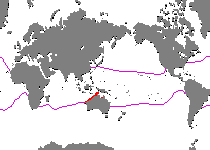
Range - Lophiocharon hutchinsi - Verbreitung
|
||||||||
| North Australia, Southern New Guinea and Aru island, Indonesia (= Southeast Asia). Restricted to this area, uncommon. It is interesting that when sea levels fell during the Pleistocene
ice age the Aru islands were part of the continent Sahul, a landmass
which was formed by Australia, Papua New Guinea and the exposed
part of the Sahul shelf (see animation
/ map).
The landbridges which formed during the ice age were used by animals
and humans to migrate from Asia to Australia (illustration). |
Nord Australien, südliches Neuguinea und Aru-Insel, Indonesien (= Südost-Asien). Nur in diesem Gebiet zu finden, selten. Interessant ist in diesem Zusammenhang, dass die Aru Inseln während
der letzten Eiszeit (Pleistozän) mit Papua Neuguinea und
Australien verbunden waren (siehe Animation
/ Karte).
Diese zusammenhängende Landmasse wird Sahul oder Meganesia
genannt. Auf den Landbrücken welche durch den sinkenden Meeresspiegel
gebildet wurden wanderten sowohl Tiere als auch Menschen von Asien
nach Australien (Illustration).
|
|||||||
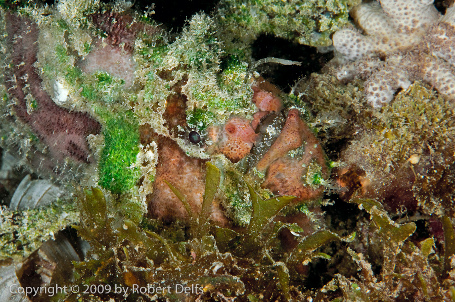
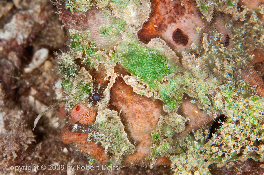
Photos - Lophiocharon hutchinsi - FotosAll these images are actually from Irian Jaya and not from the Aru Sea. To me it is not clear, if these are specimens of the rare Hutchins' Anglerfish (Lophiocharon hutchinsi) or if it is the much commoner Marble-Mouthed Frogfish (Lophiocharon lithinostomus) whose lure has been bitten off and has regrown smaller (!!) - see examples of bitten off lures
|
||||||||